

Replies
89
Beach Fanatic
Looks much farther west to me.


AdminAuthor

Edited
AdminAuthor

Beach Comber
unfortunately, the new forecast shows the wind strength increasing to 115 knots by landfall which makes it a weak cat 4. Bummer for wherever it lands--hope they are dead wrong.
AdminAuthor

AdminAuthor
Beach Fanatic
I'm no weatherman but it sure doesn't look like there is anything in those loops that is going to force this thing northward. 
AdminAuthor
I'm no weatherman but it sure doesn't look like there is anything in those loops that is going to force this thing northward.
I try to glean some of the future direction from the loops but the steering winds are the very high ones which usually don't show on the loops. Sometimes you can see some high clouds on the visible loop.
Beach Lover
Having just made the call to have my SoWal house boarded, now it looks like I might be evacuating to SoWal (from New Orleans) in a day or so.
Hurricane Season. Gotta Love it.
Hurricane Season. Gotta Love it.
AdminAuthor
Having just made the call to have my SoWal house boarded, now it looks like I might be evacuating to SoWal (from New Orleans) in a day or so.
Hurricane Season. Gotta Love it.
Head west or north. ;-)

Christini Zambini
Check out this link http://www.weatherunderground.com/blog/JeffMasters/show.html
Good explanation about Katrina's track. Looks like she is becoming a greater threat to New Orleans. That is very bad. Good news is that Dr. Masters doesn't think she'll reach cat4 because of the dry air from the north. You can see it on Kurt's link of the satellite water vapor loop. The dry air is red.
Good explanation about Katrina's track. Looks like she is becoming a greater threat to New Orleans. That is very bad. Good news is that Dr. Masters doesn't think she'll reach cat4 because of the dry air from the north. You can see it on Kurt's link of the satellite water vapor loop. The dry air is red.
Beach Fanatic
Having just made the call to have my SoWal house boarded, now it looks like I might be evacuating to SoWal (from New Orleans) in a day or so.
Hurricane Season. Gotta Love it.
As mentioned in another thread, if this thing hits NOLA as a Cat 4...well, I just don't want to think about it.
Maybe they're all wrong and it will continue west straight into Mexico.
Beach Lover
I think they will shift the model tracks back eastward. After the latest forecast tracks came out, Katrina started showing a northward component to its movement. If this continues, the models will definitely shift eastward again.
Model Tracks & Floater Image
Model Tracks & Floater Image
Edited
AdminAuthor
After the latest forecast tracks came out, Katrina started showing a northward component to its movement.
Model Tracks & Floater Image
I don't see it yet - probably a wobble.
4pm CST - KATRINA IS MOVING TOWARD THE WEST-SOUTHWEST NEAR 8 MPH. THIS MOTION IS FORECAST TO CONTINUE THIS EVENING...WITH A GRADUAL TURN TOWARDTHE WEST EXPECTED ON SATURDAY.
AN INTERMEDIATE ADVISORY WILL BE ISSUED BY THE NATIONAL HURRICANE CENTER AT 8 PM EDT FOLLOWED BY THE NEXT COMPLETE ADVISORY AT 11 PMEDT.
Edited
Beach Fanatic
I think they will shift the model tracks back eastward. After the latest forecast tracks came out, Katrina started showing a northward component to its movement. If this continues, the models will definitely shift eastward again.
Model Tracks & Floater Image
Disagree. We need some positive karma here and you ain't providing it, bro.
Beach Lover
I would love for it to go to LA. or even furher west. It might have just been a one time wobble. For those with Knology Channel 29 is a radar channel and is set on Katrina. Watching to see if the trend continues.
Beach Lover
.... Looks like she is becoming a greater threat to New Orleans. That is very bad. ... .
People here (in NOLA) aren't getting worried at all, yet. Very calm. Just watching it to see when it turns N, which would be the real indicator on probable landfall. If it heads any further west, then there will be pandemonium here tomorrow, but SoWal then might be in the clear. It's that last minute right hook it is supposed to do which alarms me. Ivan was like that--was like a bullet towards NOLA, then turned NE the morning b/f.

Beach Lover
We have a place in the French Quarter in NO that's our second home - a Cat 4 and higher in New Orleans could put water twenty or more feet above our doorstep if the surge from the Lake broke the levies - I don't want it here, but it really doesn't need to go there. Major loss of life, city probably wouldn't be inhabitable for weeks - maybe months. Baad news.
I'm hoping for Mexico or Gary, IN
I'm hoping for Mexico or Gary, IN
Beach Lover
We have a place in the French Quarter in NO that's our second home - a Cat 4 and higher in New Orleans could put water twenty or more feet above our doorstep if the surge from the Lake broke the levies - I don't want it here, but it really doesn't need to go there. Major loss of life, city probably wouldn't be inhabitable for weeks - maybe months. Baad news.
I'm hoping for Mexico or Gary, IN
Oh please, let's not start yet with the "hurricane hitting NOLA" scenario. I expect it tomorrow night on the evening news ("Well, Bob, we expect that 1/2 will die from the flooding, and the other half 1/2 will die from exposure after being trapped on their roof for days fending off snakes and alligators..." (with nifty simulations on exactly how this will occur)).
It's that little extra lagniappe that makes Louisiana stand apart from the rest.
We'll start freaking (and/or drinking) in a day or so if this continues. The ax, BTW, is to chop through the roof.

Beach Fanatic
Check this latest GFS projection:
http://www.nco.ncep.noaa.gov/pmb/nwprod/analysis/namer/gfs/18/index_85v_mu_loop.shtml
Unfortunately, I am in Red Stick right now. Amazingly, there is a lot of complacency here. The TV stations in BR mention a perhaps western shift but not alot of concern. I understand that NOLA TV is about the same. Not good.
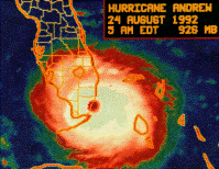
It looks like an Andrew wannabe.
http://www.nco.ncep.noaa.gov/pmb/nwprod/analysis/namer/gfs/18/index_85v_mu_loop.shtml
Unfortunately, I am in Red Stick right now. Amazingly, there is a lot of complacency here. The TV stations in BR mention a perhaps western shift but not alot of concern. I understand that NOLA TV is about the same. Not good.
It looks like an Andrew wannabe.
Beach Fanatic
Disagree. We need some positive karma here and you ain't providing it, bro.
Amen, brother!
Beach Lover
Well, thanks Travel2Much. I'm well known as an overly dramatic cry baby lose my **** at the first sign of trouble sorta guy. Thanks for slapping me sober. I feel much better now.
fishlips
Finally read the old Katrina thread - best was (paraphrased) "maybe we'll see how the GeoTubes do".
And so, just for kicks (and since there's really nothing we can do about it anyway regardless until Monday AM), and just in case it does hit or affect the area, betting may now begin on the following:
GeoTubes:
1) Missing (and not abducted by aliens thinking they were huge albino cows)
2) Popped (with the appropriate leaking of yecchy fill)
3) Intact (whether or not they did their job of protecting whatever)
GeoTube Impact:
1) Nothing Whatsoever (No worse or better protection, no sand capture)
2) Worse! (This does not include yecchy fill leaks, but washouts behind, etc)
3) Amazing! (It protected the beach and there's sand dunes up to the sky!)
I say:
Five bucks on missing GeoTubes.
and
Five bucks on a popped Tube mess, but the tubes are still there.
Put a drink in those wringing hands and relax until there's more data.
oh yeah, five more on Worse! (almost too relaxed!)
And so, just for kicks (and since there's really nothing we can do about it anyway regardless until Monday AM), and just in case it does hit or affect the area, betting may now begin on the following:
GeoTubes:
1) Missing (and not abducted by aliens thinking they were huge albino cows)
2) Popped (with the appropriate leaking of yecchy fill)
3) Intact (whether or not they did their job of protecting whatever)
GeoTube Impact:
1) Nothing Whatsoever (No worse or better protection, no sand capture)
2) Worse! (This does not include yecchy fill leaks, but washouts behind, etc)
3) Amazing! (It protected the beach and there's sand dunes up to the sky!)
I say:
Five bucks on missing GeoTubes.
and
Five bucks on a popped Tube mess, but the tubes are still there.
Put a drink in those wringing hands and relax until there's more data.
oh yeah, five more on Worse! (almost too relaxed!)
Edited
fishlips
And no huge bets on popped Tubes and Navy Seal knife work in the middle of the night, ya'll!
That's it - relax.
That's it - relax.
Beach Fanatic
Here comes a really boring post. Borage, but heartfelt.
Folks, I'd like to point out here that we're not out of the woods. The models have recently shifted west to the Mississippi area, but this type of storm is very hard to predict....both the path and the intensity. Any slight change of path when a recurvature is predicted can amount to a very large difference in landfall location. Please don't get complacent now. This could be a very serious storm and it still has the possibility of turning this way...and it could do that with little warning. Stay on the toes por favor?
Folks, I'd like to point out here that we're not out of the woods. The models have recently shifted west to the Mississippi area, but this type of storm is very hard to predict....both the path and the intensity. Any slight change of path when a recurvature is predicted can amount to a very large difference in landfall location. Please don't get complacent now. This could be a very serious storm and it still has the possibility of turning this way...and it could do that with little warning. Stay on the toes por favor?
Thread locked
This conversation is read-only until a moderator unlocks it.