
Hopefully it will drift west across the Yucatan and into Mexico. I am not wishing anything bad for those folks, just want the season to end. For the next few days there won't be much movement at all.
Model Tracks & Floater Image
Replies
80
Beach Fanatic
Re: TD 24 Forecast to become a hurricane
 :rofl:
WILMA....BAM-BAM.....PEBBLES??.....and the installation of the Flintstones Waterpark in the 30A subdivision.....merely a COINCIDENCE????
 :rofl:

Beach Fanatic
Re: TD 24 Forecast to become a hurricane
Today - groceries, including bottled water and a few batteries.
Tomorrow - groceries, including canned meats (yuk) and a few batteries.
The next day - a different store, for groceries, water and batteries.

Today - groceries, including bottled water and a few batteries.
Tomorrow - groceries, including canned meats (yuk) and a few batteries.
The next day - a different store, for groceries, water and batteries.

Darlene is my middle name, not my nickname
Re: TD 24 Forecast to become a hurricane
Don't forget the beer, or other type of alcohol if you are not a beer drinker..just helping a fellow poster out!!!!
Today - groceries, including bottled water and a few batteries.
Tomorrow - groceries, including canned meats (yuk) and a few batteries.
The next day - a different store, for groceries, water and batteries.
Don't forget the beer, or other type of alcohol if you are not a beer drinker..just helping a fellow poster out!!!!

SoWal Insider
Re: TD 24 Forecast to become a hurricane
At least we have somewhere to evacuate. SoWal here we come!!
Today - groceries, including bottled water and a few batteries.Bought my supplies yesterday at the Publix in South Tampa. Freaked out a couple of people in line. Felt like a worrywart until I woke up to see TS Wilma on the news. I think we have a bit more to worry about here than SoWal at this point. The most recent models forecast a decisive right turn, but it is of course too early to tell.
Tomorrow - groceries, including canned meats (yuk) and a few batteries.
The next day - a different store, for groceries, water and batteries.
At least we have somewhere to evacuate. SoWal here we come!!

SoWal Expert
Re: TD 24 Forecast to become a hurricane
TS Wilma has gained another 25% in Max Sustained Wind Speed, since I posted this morning. Since yesterday morning its wind speed has almost doubled. Look out!

TS Wilma has gained another 25% in Max Sustained Wind Speed, since I posted this morning. Since yesterday morning its wind speed has almost doubled. Look out!
Beach Fanatic
Re: TD 24 Forecast to become a hurricane
Aargh...this is awful! I definitely don't want Wilma the Witch hitting SoWal, but I don't want her following me to NOLA either! I've been assigned to work down there for the month of November. There's enough work down there without Wilma creating more havoc! I like the idea of parking Bob on the beach and scaring Wilma back to where she came from

I hear talk by some folks saying that the Gulf is too cold for hurricanes. In reality, it may feel cold to your skin, but it is warm enough to get the hurricanes going. I seeTS Wilma is still gaining wind speed and this will probably continue if she keeps her line towards New Orleans, where she is currently pointing. Over the last 24 hours, Wilma's wind speed has increased 33%.
Better keep a watchful eye out for Wilma.
Aargh...this is awful! I definitely don't want Wilma the Witch hitting SoWal, but I don't want her following me to NOLA either!
I've been assigned to work down there for the month of November. There's enough work down there without Wilma creating more havoc! I like the idea of parking Bob on the beach and scaring Wilma back to where she came from 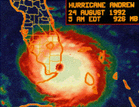
Beach LoverAuthor
Re: TD 24 Forecast to become a hurricane
I don't want to wish harm on anyone but I like the latest models. They keep Wilma away from Northwest Florida. Just hope it stands. Sorry central and south FL.
Model tracks & Floater Image
I don't want to wish harm on anyone but I like the latest models. They keep Wilma away from Northwest Florida. Just hope it stands. Sorry central and south FL.
Model tracks & Floater Image
SoWal Expert
Re: TD 24 Forecast to become a hurricane
Wilma is very close to becoming a Hurricane. She is now at 65 mph sustained wind speed. She has increased speed rapidly in the last two days. Currently, she is looking like whe wants to head to Tampa, although she can change in only a moment. Look out down there.
Wilma is very close to becoming a Hurricane. She is now at 65 mph sustained wind speed. She has increased speed rapidly in the last two days. Currently, she is looking like whe wants to head to Tampa, although she can change in only a moment. Look out down there.
SoWal Insider
Re: TD 24 Forecast to become a hurricane
Tropicwatch, all the models have the storm taking a hard right on Friday. Why such a sharp turn, and is that a fairly sure thing? A more usual curvature would hammer us here in the TPA, so I'm trying to know whether I should feel better or not.
Where's the nailbiting smiley?
Tropicwatch, all the models have the storm taking a hard right on Friday. Why such a sharp turn, and is that a fairly sure thing? A more usual curvature would hammer us here in the TPA, so I'm trying to know whether I should feel better or not.
Where's the nailbiting smiley?
SoWal Insider
Re: TD 24 Forecast to become a hurricane
Tropicwatch, all the models have the storm taking a hard right on Friday. Why such a sharp turn, and is that a fairly sure thing? A more usual curvature would hammer us here in the TPA, so I'm trying to know whether I should feel better or not.We used to live in Palm Harbor. Are you in Tampa or more in the St. Pete area? There is always such terrible flooding in St. Pete with all the canals and low lying land. I'd be biting my nails too! There are so few roads exiting the peninsula. Besides, it's been a very, very long time since there's been a hurricane in the area.
Where's the nailbiting smiley?

SoWal Insider
Re: TD 24 Forecast to become a hurricane
I don't want to wish harm on anyone but I like the latest models. They keep Wilma away from Northwest Florida. Just hope it stands. Sorry central and south FL.The omnipotent force is just working as planned.
Model tracks & Floater Image
SoWal Insider
Re: TD 24 Forecast to become a hurricane
I'm on a different peninsula -- South Tampa, which is the area between Kennedy Ave. and MacDill AFB. We are about 3/4 mile from Tampa Bay and in a pretty high neighborhood, but if a major hurricane slices up Tampa Bay, we are in trouble. We'd probably be OK flood-wise in a Cat 3 direct hit, but most of South Tampa would be underwater. Which reminds me. I meant to get flood insurance this year but didn't. At least our house is up on a crawl space.
We used to live in Palm Harbor. Are you in Tampa or more in the St. Pete area? There is always such terrible flooding in St. Pete with all the canals and low lying land. I'd be biting my nails too! There are so few roads exiting the peninsula. Besides, it's been a very, very long time since there's been a hurricane in the area.
I'm on a different peninsula -- South Tampa, which is the area between Kennedy Ave. and MacDill AFB. We are about 3/4 mile from Tampa Bay and in a pretty high neighborhood, but if a major hurricane slices up Tampa Bay, we are in trouble. We'd probably be OK flood-wise in a Cat 3 direct hit, but most of South Tampa would be underwater.
Which reminds me. I meant to get flood insurance this year but didn't. At least our house is up on a crawl space.SoWal Insider
Re: TD 24 Forecast to become a hurricane
I'm on a different peninsula -- South Tampa, which is the area between Kennedy Ave. and MacDill AFB. We are about 3/4 mile from Tampa Bay and in a pretty high neighborhood, but if a major hurricane slices up Tampa Bay, we are in trouble. We'd probably be OK flood-wise in a Cat 3 direct hit, but most of South Tampa would be underwater.We neve had flood insur. either and we were only about 2 blks. from the shoreline (Ozona area). Well, stay tuned. I just hope the area will be prepared IF it somes your way. Let's hope that it lessens in strength!!
Beach LoverAuthor
Re: TD 24 Forecast to become a hurricane
The strong right turn in the models are in anticipation of a strong frontal system. This time of year it is quite possible. I have not looked that closely but that is usually the reason for such a significant turn.
Model Tracks & Floater Image
Tropicwatch, all the models have the storm taking a hard right on Friday. Why such a sharp turn, and is that a fairly sure thing? A more usual curvature would hammer us here in the TPA, so I'm trying to know whether I should feel better or not.
Where's the nailbiting smiley?
The strong right turn in the models are in anticipation of a strong frontal system. This time of year it is quite possible. I have not looked that closely but that is usually the reason for such a significant turn.
Model Tracks & Floater Image
SoWal Insider
Re: TD 24 Forecast to become a hurricane
Thanks TW. And johnrudy -- I'm sure you know how lackadaisical we are around here. It has been 80 years I think. We are due. :shock:

The strong right turn in the models are in anticipation of a strong frontal system. This time of year it is quite possible. I have not looked that closely but that is usually the reason for such a significant turn.
Model Tracks & Floater Image
Thanks TW. And johnrudy -- I'm sure you know how lackadaisical we are around here. It has been 80 years I think. We are due. :shock:

Meow
Re: TD 24 Forecast to become a hurricane
That and your skeery face. Thanks Bob. Wasn't it generators last time?
The omnipotent force is just working as planned.
That and your skeery face. Thanks Bob. Wasn't it generators last time?
SoWal Insider
Re: TD 24 Forecast to become a hurricane
That and your skeery face. Thanks Bob. Wasn't it generators last time?The generator theory went the way of my stock market advice, as Dennis came through and the need arose to hire the omnipotent force.
Beach Comber
Re: TD 24 Forecast to become a hurricane
This is the latest update. We shouldn't be too smug until we see it crossing the peninsula.(Edited for clarity)
THE NEW FORECAST TRACK IS ADJUSTED SOMEWHAT TO THE LEFT FOR THE FIRST 48 HR BASED ON THE CURRENT POSITION AND MOTION...WITH THE REMAINDER OF THE FORECAST TRACK SIMILAR TO THE PREVIOUS ADVISORY IN AGREEMENT WITH THE MODEL CONSENSUS. IT SHOULD BE NOTED THAT THE MODELS DO NOT COMPLETELY AGREE ON HOW THE EASTERN U. S. TROUGH WILL EVOLVE...AND THESE DIFFERENCES COULD MAKE A SIGNIFICANT DIFFERENCE IN WHAT PARTS OF FLORIDA WILMA WILL ULTIMATELY AFFECT.
THE INTENSITY FORECAST HAS BECOME MORE COMPLICATED. THE CURRENT
RAPID INTENSIFICATION AND FAVORABLE ENVIRONMENT SHOULD BRING WILMA TO CATEGORY FOUR STATUS IN THE NEXT 24 HR...AND IT WOULD NOT BE A SURPRISE TO SEE IT REACH CATEGORY FIVE BEFORE IT BOTTOMS OUT.
WHEN WILMA MOVES INTO THE GULF OF MEXICO...IT SHOULD ENCOUNTER SLIGHTLY COOLER SEA SURFACE TEMPERATURES AND GRADUALLY INCREASING VERTICAL SHEAR. THIS SHOULD CAUSE A SLOW WEAKENING...ALTHOUGH IT IS PROBABLE THAT WILMA WILL STILL BE A MAJOR HURRICANE WHEN IT REACHES THE FLORIDA PENINSULA
The strong right turn in the models are in anticipation of a strong frontal system. This time of year it is quite possible. I have not looked that closely but that is usually the reason for such a significant turn.
Model Tracks & Floater Image
This is the latest update. We shouldn't be too smug until we see it crossing the peninsula.(Edited for clarity)
THE NEW FORECAST TRACK IS ADJUSTED SOMEWHAT TO THE LEFT FOR THE FIRST 48 HR BASED ON THE CURRENT POSITION AND MOTION...WITH THE REMAINDER OF THE FORECAST TRACK SIMILAR TO THE PREVIOUS ADVISORY IN AGREEMENT WITH THE MODEL CONSENSUS. IT SHOULD BE NOTED THAT THE MODELS DO NOT COMPLETELY AGREE ON HOW THE EASTERN U. S. TROUGH WILL EVOLVE...AND THESE DIFFERENCES COULD MAKE A SIGNIFICANT DIFFERENCE IN WHAT PARTS OF FLORIDA WILMA WILL ULTIMATELY AFFECT.
THE INTENSITY FORECAST HAS BECOME MORE COMPLICATED. THE CURRENT
RAPID INTENSIFICATION AND FAVORABLE ENVIRONMENT SHOULD BRING WILMA TO CATEGORY FOUR STATUS IN THE NEXT 24 HR...AND IT WOULD NOT BE A SURPRISE TO SEE IT REACH CATEGORY FIVE BEFORE IT BOTTOMS OUT.
WHEN WILMA MOVES INTO THE GULF OF MEXICO...IT SHOULD ENCOUNTER SLIGHTLY COOLER SEA SURFACE TEMPERATURES AND GRADUALLY INCREASING VERTICAL SHEAR. THIS SHOULD CAUSE A SLOW WEAKENING...ALTHOUGH IT IS PROBABLE THAT WILMA WILL STILL BE A MAJOR HURRICANE WHEN IT REACHES THE FLORIDA PENINSULA
SoWal Insider
Re: TD 24 Forecast to become a hurricane
150 mph winds at 1 a.m. This thing just became a hurricane Tuesday morning. It is just insanity!
150 mph winds at 1 a.m. This thing just became a hurricane Tuesday morning. It is just insanity!
SoWal Insider
Re: TD 24 Forecast to become a hurricane
150 mph winds at 1 a.m. This thing just became a hurricane Tuesday morning. It is just insanity!And now, it's a cat. 5!!!!!!!!!!

Beach Fanatic
Re: TD 24 Forecast to become a hurricane
All this happen since I went to bed last night??? That is unbelieveable!
All this happen since I went to bed last night???
That is unbelieveable!Meow
Re: TD 24 Forecast to become a hurricane
Holy Cow! I just turned on the TV and saw that...last time I heard it was Cat. 2! Just read that the biatch has sustained winds of 175 mph and has the lowest record pressure in Atlantic Basin ever recorded.
And now, it's a cat. 5!!!!!!!!!!
Holy Cow! I just turned on the TV and saw that...last time I heard it was Cat. 2! Just read that the biatch has sustained winds of 175 mph and has the lowest record pressure in Atlantic Basin ever recorded.

fishlips
Re: TD 24 Forecast to become a hurricane
same thing katrina and rita did - went from ts to cat 5 super fast
http://www.unknowncountry.com/news/?id=4949
same thing katrina and rita did - went from ts to cat 5 super fast
http://www.unknowncountry.com/news/?id=4949
SoWal Expert
Re: TD 24 Forecast to become a hurricane
Crazy, gusts are over 200mph. Wilma ain't so pretty. I always thought that Betty looked better anyway. You guys in SoFL better look out, even though the cold front is supposed to slow it down. Three days ago, Wilma's wind speed was only 30 mph. Only 1.5 months left of hurricane season.
Crazy, gusts are over 200mph. Wilma ain't so pretty. I always thought that Betty looked better anyway. You guys in SoFL better look out, even though the cold front is supposed to slow it down. Three days ago, Wilma's wind speed was only 30 mph. Only 1.5 months left of hurricane season.
fishlips
Re: TD 24 Forecast to become a hurricane
lets see, backwards that would be 2121555580, or did my dislexia kick in again?
1000 101...10
lets see, backwards that would be 2121555580, or did my dislexia kick in again?
Checking your forum account
Please wait while we verify your forum account.