


Well it appears we have our first Tropical Depression which is forecast to become a tropical storm by tomorrow...
Replies
97
little sugar
I hope this one passes you by.......

SoWal Expert
I hope this one passes you by.......I hope so too. I have very little gas in my cars, no extra dog food, no bottled water, no batteries (but nothing for them to go into anyway), no food stored, etc. About the only thing I do have is a couple of life jackets which I may use if the water rises high enough that I can paddle my canoe down the street to the Gulf. I am really not expecting much from this storm -- Maybe a bit of rain and lightning, which is always exciting.
SoWal Expert
The latest from the National Hurricane Center:
BULLETIN
TROPICAL STORM ARLENE INTERMEDIATE ADVISORY NUMBER 10A
NWS TPC/NATIONAL HURRICANE CENTER MIAMI FL
8 PM EDT FRI JUN 10 2005
...RECENT DATA FROM A NOAA HURRICANE HUNTER AIRCRAFT INDICATE THAT
MAXIMUM SUSTAINED WINDS HAVE NOW INCREASED TO NEAR 70 MPH...WITH
HIGHER GUSTS...AND THESE WINDS ARE OCCURRING MAINLY TO THE NORTH
AND EAST OF THE CENTER. SOME STRENGTHENING IS FORECAST DURING THE
NEXT 24 HOURS...AND ARLENE COULD BECOME A HURRICANE LATER TONIGHT
OR ON SATURDAY.
TROPICAL STORM FORCE WINDS EXTEND OUTWARD UP TO 150 MILES... MAINLY
TO THE NORTH AND EAST OF THE CENTER....
BULLETIN
TROPICAL STORM ARLENE INTERMEDIATE ADVISORY NUMBER 10A
NWS TPC/NATIONAL HURRICANE CENTER MIAMI FL
8 PM EDT FRI JUN 10 2005
...RECENT DATA FROM A NOAA HURRICANE HUNTER AIRCRAFT INDICATE THAT
MAXIMUM SUSTAINED WINDS HAVE NOW INCREASED TO NEAR 70 MPH...WITH
HIGHER GUSTS...AND THESE WINDS ARE OCCURRING MAINLY TO THE NORTH
AND EAST OF THE CENTER. SOME STRENGTHENING IS FORECAST DURING THE
NEXT 24 HOURS...AND ARLENE COULD BECOME A HURRICANE LATER TONIGHT
OR ON SATURDAY.
TROPICAL STORM FORCE WINDS EXTEND OUTWARD UP TO 150 MILES... MAINLY
TO THE NORTH AND EAST OF THE CENTER....

Admin
If it stays on track, I pity those poor folk in P-cola. They've had enough already.
Beach Lover
I am just checking to see how things are from Destin to Rosemary Beach
I am sure nobody has power
Be safe
I am sure nobody has power
Be safe
Beach Comber
Power is not out, it's barely raining. Surf's up though, and looks like we'll lose more sand.
Admin
Hi guys - breezy and rainy is all for now.

Beach Lover
Good to hear, Kurt..we are headed down, supposedly, tomorrow. Watching the Weather Channel and beyond thrilled to not see Stephanie Abrams, bless her heart.
Nan,formerly known as BlueMountainBeacher
Nan,formerly known as BlueMountainBeacher
Admin
Good to hear, Kurt..we are headed down, supposedly, tomorrow. Watching the Weather Channel and beyond thrilled to not see Stephanie Abrams, bless her heart.
Nan,formerly known as BlueMountainBeacher
"watch out, watch out, WATCH OUT!"

Beach Lover

Beach Fanatic
Looks like surf's up from the beach cams. Anybody been to the beach this morning? Wondering if the surf's making it up to those un-vegetated piles of sand yet.
Admin
DeFuniak Springs, FL ?Tropical Storm Arlene continues toward the Gulf Coast. This storm is expected to make landfall later this afternoon. Sustained winds are presently at 70 mph.
A tropical storm warning and tornado watch are currently in effect along the Gulf Coast. A flood watch is also in effect. Rain will continue throughout the day and rainfall will be in the 5 to 8 inch range, with heavier amounts possible. This could cause flooding of low lying areas.
Residents should remain home, if possible, and stay off the roads. It is unsafe to travel due to the heavy rainfall and high wind conditions.
The Emergency Operation Center was activated Friday evening and will remain in activation until the storm has cleared the area. Citizen?s information lines have been set-up at the EOC to assist concerned citizens. The emergency information lines, 892-8392 or 892-8394, are currently operating. The Emergency Operations Center number is 892-8065.
Walton County has declared a Local State of Emergency and has issued a Volunteer Evacuation Notice to all trailer parks, mobile home owners, and residents in low lying and coastal areas. All RV and camp grounds should be closed at this time.
Walton County?s beaches are closed until further notice. Storm surge will be about 3 to 5 feet above normal, causing beach erosion and some coastal flooding.
It is important to remember rip currents often occur before, during and after a hurricane. Do not attempt to go to the beach and swim or surf. Heavy surf conditions combined with rip currently produce dangerous and often fatal conditions.
At the present time tropical storm force winds on the Clyde B. Wells over the Choctawhatchee Bay are approximately 30 mph. There are no plans to close the bridge at this time but residents are reminded the bridge is closed when winds reach 40 mph and local radio and TV stations should be monitored for updates from the EOC.
A shelter is manned by the American Red Cross and available at Freeport High School for both the general population and those with special needs. Animals are not accepted at the shelter.
A tropical storm warning and tornado watch are currently in effect along the Gulf Coast. A flood watch is also in effect. Rain will continue throughout the day and rainfall will be in the 5 to 8 inch range, with heavier amounts possible. This could cause flooding of low lying areas.
Residents should remain home, if possible, and stay off the roads. It is unsafe to travel due to the heavy rainfall and high wind conditions.
The Emergency Operation Center was activated Friday evening and will remain in activation until the storm has cleared the area. Citizen?s information lines have been set-up at the EOC to assist concerned citizens. The emergency information lines, 892-8392 or 892-8394, are currently operating. The Emergency Operations Center number is 892-8065.
Walton County has declared a Local State of Emergency and has issued a Volunteer Evacuation Notice to all trailer parks, mobile home owners, and residents in low lying and coastal areas. All RV and camp grounds should be closed at this time.
Walton County?s beaches are closed until further notice. Storm surge will be about 3 to 5 feet above normal, causing beach erosion and some coastal flooding.
It is important to remember rip currents often occur before, during and after a hurricane. Do not attempt to go to the beach and swim or surf. Heavy surf conditions combined with rip currently produce dangerous and often fatal conditions.
At the present time tropical storm force winds on the Clyde B. Wells over the Choctawhatchee Bay are approximately 30 mph. There are no plans to close the bridge at this time but residents are reminded the bridge is closed when winds reach 40 mph and local radio and TV stations should be monitored for updates from the EOC.
A shelter is manned by the American Red Cross and available at Freeport High School for both the general population and those with special needs. Animals are not accepted at the shelter.

Beach Fanatic
Somewhat windy but otherwise quiet in Bluewater Bay. No utility problems, but then we never lost power or cable from Ivan either. Rain's pretty much an occasional drizzle. We're planning on heading down towards Destin for lunch later. (and bonus! no tolls on the Mid-Bay Bridge until 5:00pm tonight)
The non-tropical storms we got in early April were actually a lot worse.
The non-tropical storms we got in early April were actually a lot worse.
Beach Lover
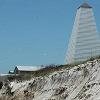
9am Report from Seaside:
The storm center is supposed to move over the coast near Pensacola about 2 pm. We have had very little wind, about 2 inches of rain, even some breaks and sun,but the surf is pounding. High tide isn't expected until noon. The currents are ripping the beach from east to west. Our first level of defense ( the hurricane fences) that are nearest the water have been ripped out. Water is under the walkover at Tupelo and lapping the stairs all the way down the beach but so far they look ok.I just wish this thing would hurry up and go....I am sure TJ is already back here checking on things. He was working battening down the hatches himself all over town until late yesterday. One good thing is our seaoats have had so much water this spring they appear to have caught , are green and growing.. I just wish they had had a little more time before storm season got underway.
The storm center is supposed to move over the coast near Pensacola about 2 pm. We have had very little wind, about 2 inches of rain, even some breaks and sun,but the surf is pounding. High tide isn't expected until noon. The currents are ripping the beach from east to west. Our first level of defense ( the hurricane fences) that are nearest the water have been ripped out. Water is under the walkover at Tupelo and lapping the stairs all the way down the beach but so far they look ok.I just wish this thing would hurry up and go....I am sure TJ is already back here checking on things. He was working battening down the hatches himself all over town until late yesterday. One good thing is our seaoats have had so much water this spring they appear to have caught , are green and growing.. I just wish they had had a little more time before storm season got underway.
Beach Lover
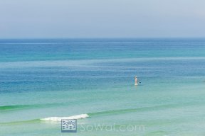
Greetings from Seacrest Beach. Overall wind and rain has not been too bad yet. Beach has eroded about 5' deep. Most sand fence is history. Starting to see more lumber floating by in the last 1/2 hour.

Beach Fanatic
Are the dune lakes likely to wash out during this thing?

Beach Comber

Beach Lover
Cavallino, Excellent photos, thanks. When and where were they taken? We have a house on 30-A at Seaside. My friend's family is going to stay at our house for the week. they will arrive there tomorrow.
Beach Fanatic
Thanks for the pics. Where are these shots from?
For live streaming video from Gulf Shores, check out:
http://www.hurricanetrack.com
For live streaming video from Gulf Shores, check out:
http://www.hurricanetrack.com
Beach Lover
The new Natchez stairs at Seaside appear to be suffering heavy damage.
Admin
Here are some Pics
http://share.shutterfly.com/action/share/welcome?i=EeAMWbRi1bNWj4w¬ag=1&x=1&sm=1&sl=1
Thanks!
Looks like the water has receded some since you were out.
Admin
Are the dune lakes likely to wash out during this thing?
Oh yeah they're all open.
Beach Lover
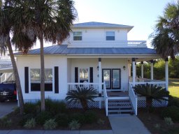
How have the beachwalkovers fared? They can't have sustained the damage they did from Ivan.
Beach Comber
I was out there around 11:30-12:15
The shots are taken at WaterColor Beach Club walkover and then at Seaside.
The few from WaterSound were taken around 10am this morning.
Doug
The shots are taken at WaterColor Beach Club walkover and then at Seaside.
The few from WaterSound were taken around 10am this morning.
Doug
Beach Lover
Walkovers are in better shape than after Ivan. A few have sustained damage but not very many here in Seacrest Beach. Saw a lot of green painted wood from Rosemary Beach floating by. We have sustained about 7-8' of beach erosion. All sand fence and a large part of the pushed up sand is gone.
Thread locked
This conversation is read-only until a moderator unlocks it.